Button CopyPathCircle CloseCircle Left ArrowArrow Down Icon GreyClosecirclecircleBurger
  • Advertising

PC19263 N/A, Kirkland Lake, Ontario, P2N 3R2

MLS® # T12651114
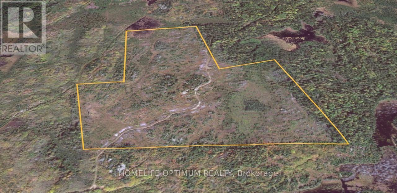
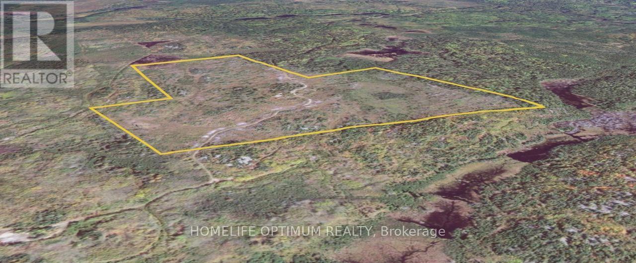
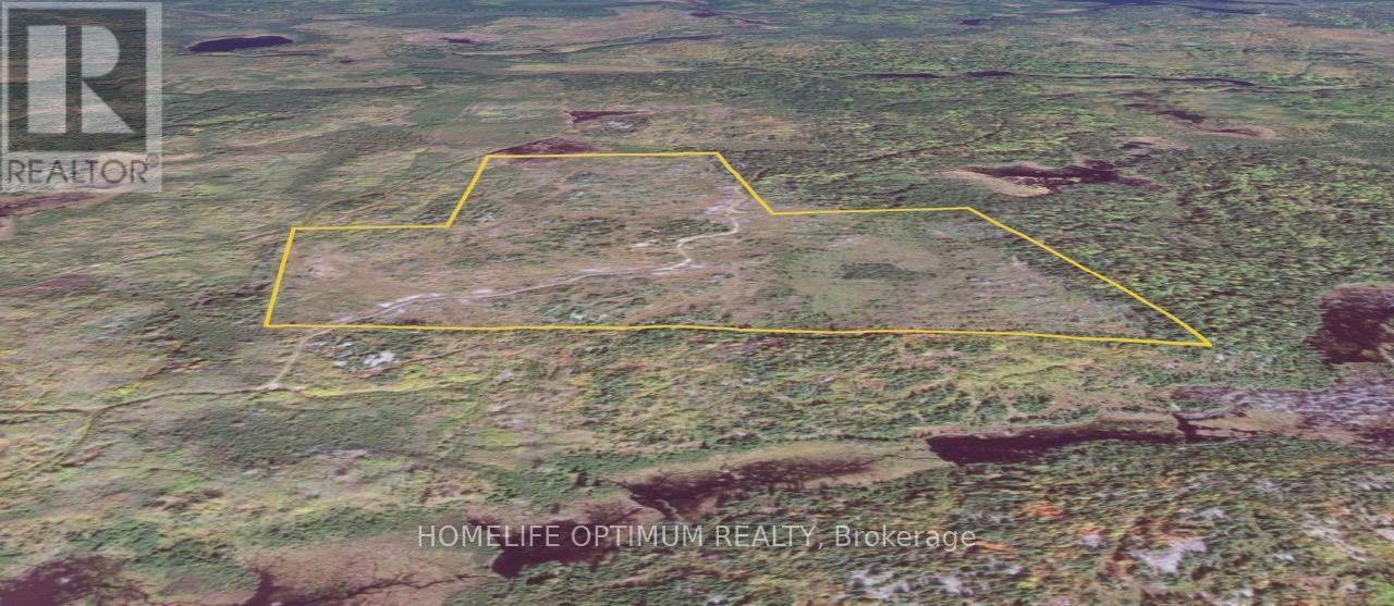
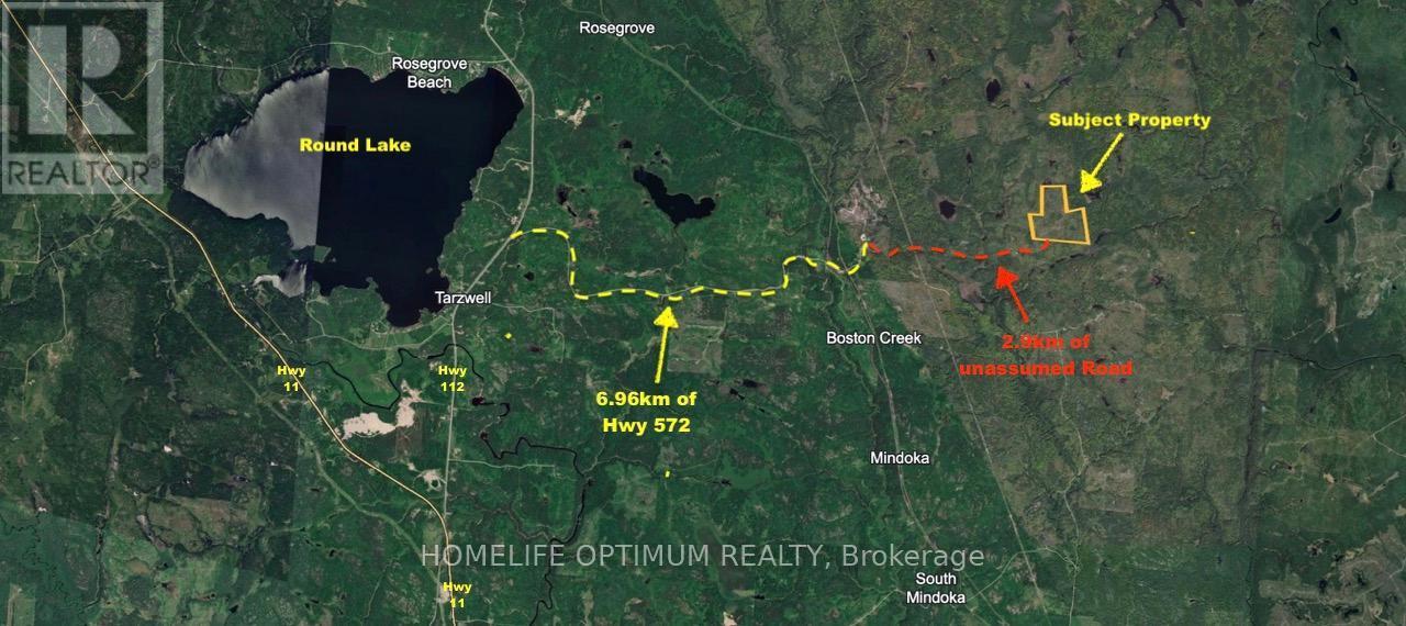
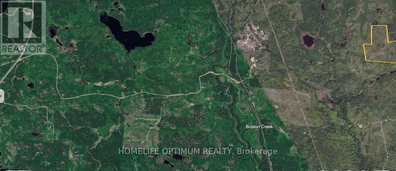
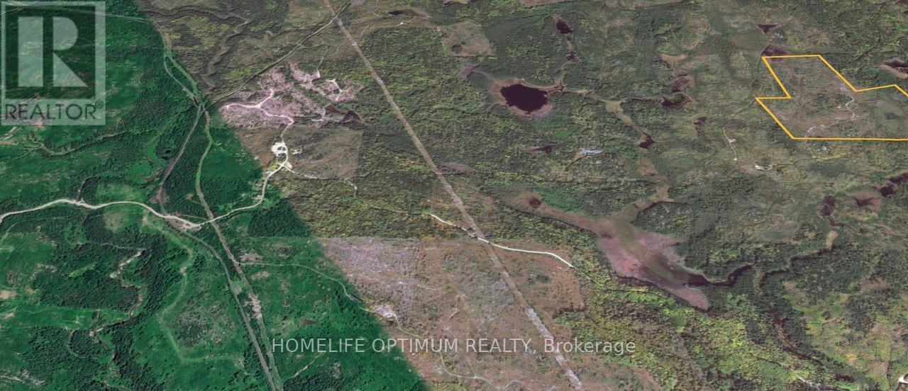
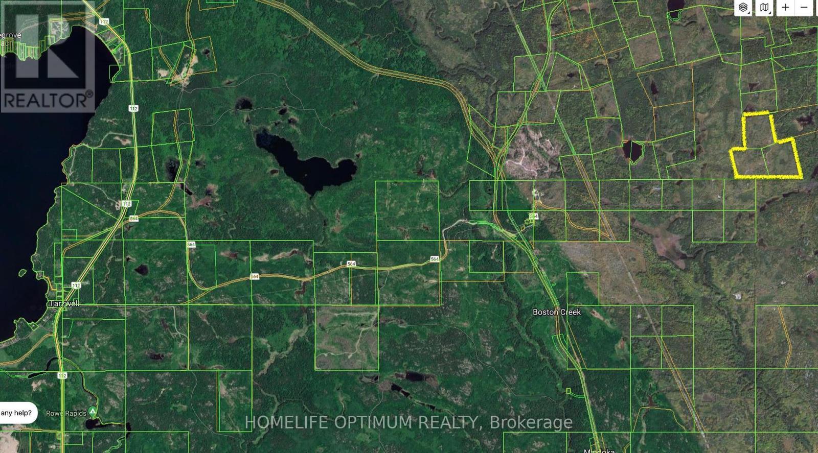
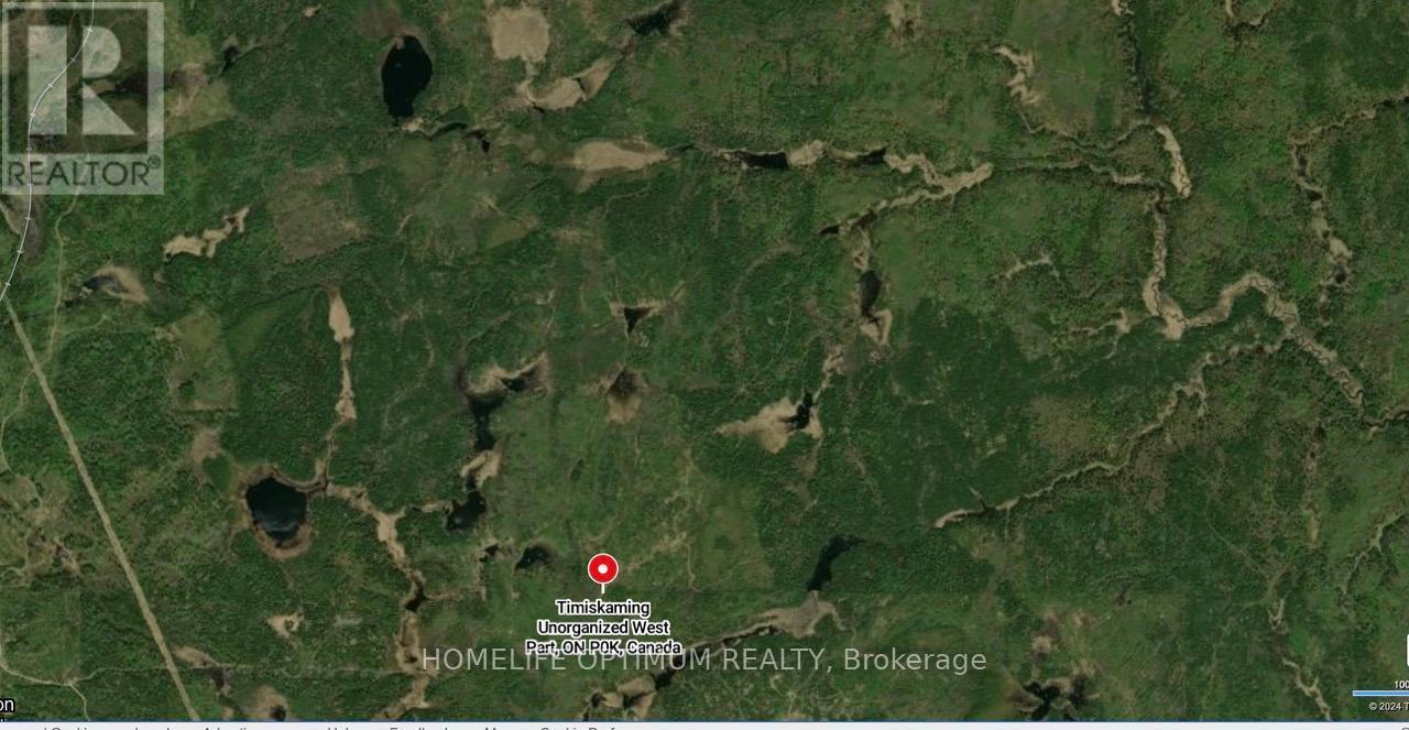
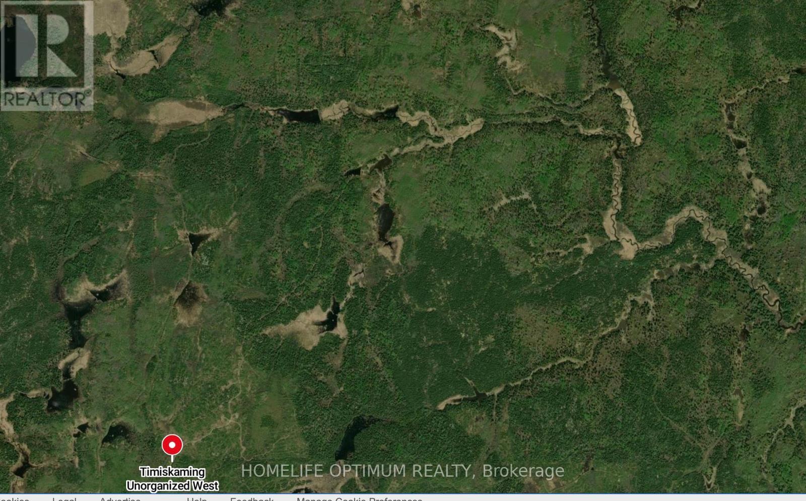
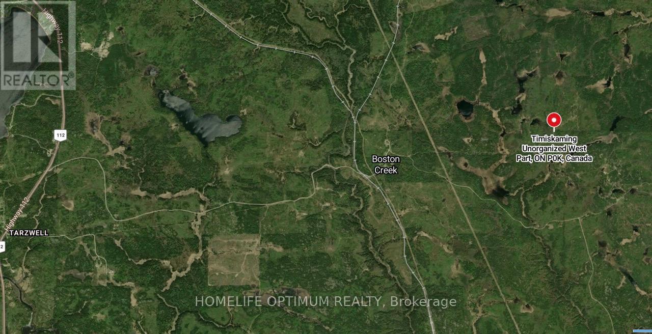
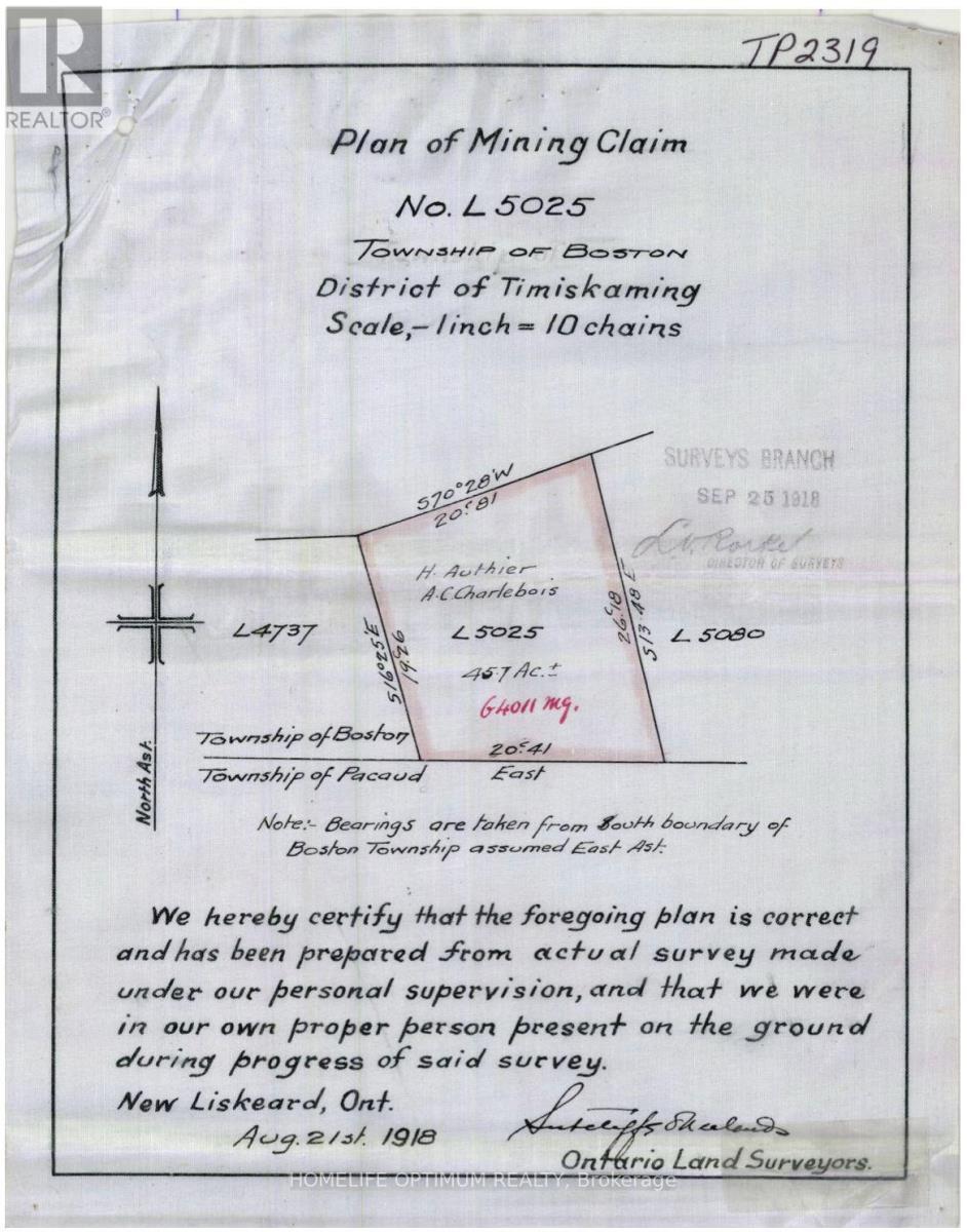
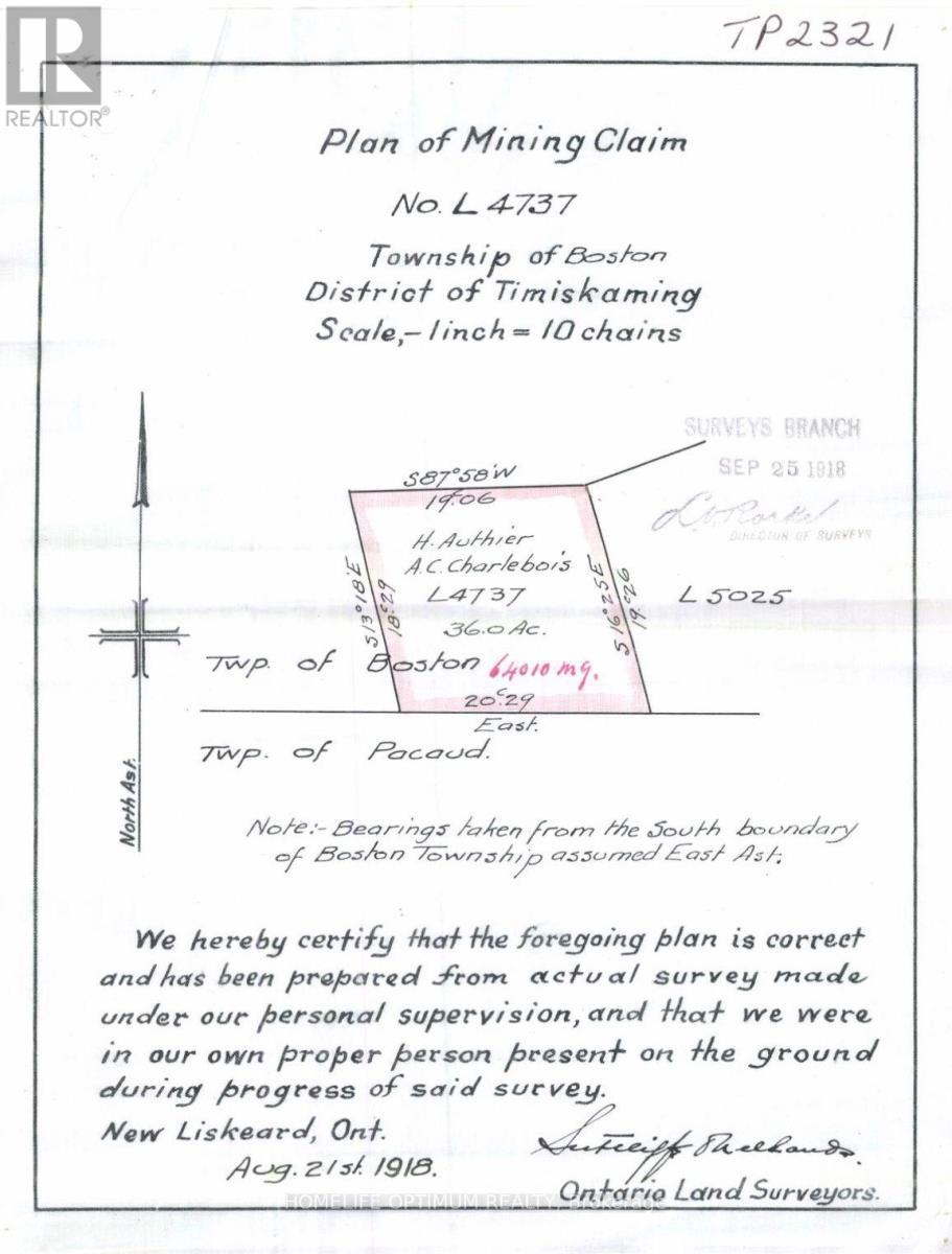
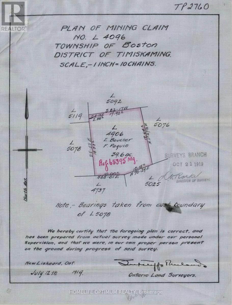
Vacant Land For Sale In Kirkland Lake, Ontario
$99,000

None Beds

Pc19263 N/A, Kirkland Lake, ON
  • Advertising
PC19263 N/A, Kirkland Lake, Ontario, P2N 3R2
$99,000

Property Information:

This 121.3-acre parcel is located in the UNORGANIZED TOWNSHIP OF BOSTON, in the District of Timisikaming. This property is located between the towns of Kirkland Lake and Englehart. Kirkland Lake is 15km north of the subject property and Englehart is 20km South.According to satellite images, there is a logging road that gives you access in the non-winter months by a 4x4 vehicle. This logging road starts at highway 112, which is roughly 8 km west of the subject property. **Please note: sections of this trail goes through private land. According to the contour maps, the surrounding area is relatively flat and dry.There are many small lakes, ponds, creeks and rivers accessible through crown land.The largest lake in the area is Round Lake.Round Lake has a surface area of 3,000 acres (1,213 hectors)It has an average depth of 60 feet (18 meters) and a max depth of 118 feet (36 meters). Rivers and Creeks in the area include:Boston Creek Mousseau Creek, and The Blanch River. The property is 121.3 acres in size and is made up of three parcels of land.Parcel 19263 = 39.6-acres, Parcel 19264 = 36-acres, Parcel 19265 = 45.7-acres SURFACE RIGHTS, & TREE RIGHTS COME WITH THIS PROPERTY other than the "Pine Rights" which are reserved to the Crown.MINERAL RIGHTS DO NOT COME WITH THIS PROPERTY AS THEY ARE WITH THE CROWN.. (id:27)

Building Features:

  • Floor Space: 121 ac

Property Features:

  • Property Type: Vacant Land
  • Floor Space (approx): 121 Square Feet
  • Irregular: Yes
  • Lot Depth: 1 Feet
  • Lot Frontage: 1 Feet
  • Lot Size: 121.30 Acres
  • Zoning: UNORGANIZED

Courtesy of: HOMELIFE OPTIMUM REALTY

REALTOR.ca  

Location of PC19263 N/A, Kirkland Lake, Ontario, P2N 3R2

Climate Risk Data

About Climate Risk: Properties are at increased risk of damage from extreme weather due to climate change.
ClimateCheck provides detailed climate risk data for properties now and up to 30 years into the future.

Projected Heat Risk: Moderate-Low

26 hot days expected in 2050

Projected Precipitation Risk: Moderate

14 storms expected in 2050

Projected Heat Risk: Moderate-Low

26 hot days expected in 2050

37/100

Moderate-Low

ClimateCheck®

Current data

This property, PC19263 N/A , experiences 7 hot days per year at around 29.5 degrees Celsius.

Projected data

Severe heat risk is expected to increase in this area. In 2050, it is projected that there will be 26 hot days at 32.7 degrees Celsius.

Projected Avg. Temperature

Past
29.5℃
2050
32.7℃

# Hot Days Per Year

Past
7
2050
26

About Heat Risk

Heat risk is the number of extreme heat days experienced each year looking at historical conditions (1980-2005) in your area and taking the 2% of the hottest days and projecting that into the future.

Projected Precipitation Risk: Moderate

14 storms expected in 2050

55/100

Moderate

ClimateCheck®

Current data

This property, PC19263 N/A , experiences 11 significant 2-day storms per year, with about 288.1mm of precipitation per storm.

Projected data

Severe storms are expected to increase in this area. In 2050, it is projected that there will be 14 significant 2-day storms with 358.6mm of precipitation per year.

Precipitation Per Storm

Past
288.1mm
2050
358.6mm

48-Hour Storms Per Year

Past
11
2050
14

About Storm Risk

Storm risk is the number of high wind, wet or snowy events each year. Climate check looks at historical conditions (1980-2005) in your area, on the days with the top 1% of total precipitation in a year and projected to 2050.

Climate risk data is provided for informational purposes only on Royallepage.ca.
If you have questions or feedback about this data, get help at climatecheck.com.

Environmental Risks provided by ClimateCheck®

Royal LePage does not endorse nor guarantee this information. By providing this information, Royal LePage and its agents are not providing advice or guidance on climate risks. Royal LePage strongly recommends that consumers independently investigate the property’s climate risks to their own personal satisfaction.

Demographic Information of PC19263 N/A, Kirkland Lake, Ontario, P2N 3R2

Life Stage

Young Couples

Employment Type

Blue Collar/Primary, Blue Collar/Service Sector

Average Household Income

$119,971.31

Average Number of Children

1.60

Household Population

Household Structure

Age of Population

Education

Education Level

No certificate/diploma/degree

24.41 %

High school certificate or equivalent

26.82 %

Apprenticeship trade certificate/diploma

9.28 %

College/non-university certificate

24.38 %

University certificate (below bachelor)

3.46 %

University Degree

11.64 %

Commuter

Travel To Work

By Car

69.87 %

By Public Transit

0.0 %

By Walking

20.85 %

By Bicycle

0.0 %

By Other Methods

9.28 %

Cultural Diversity

Knowledge of Official Language

Mother Tongue

Building Information

Building Type

Apartments (Low and High Rise)

65.46 %

Houses

34.54 %

Own Vs. Rent